Free Online Productivity Tools
i2Speak
i2Symbol
i2OCR
iTex2Img
iWeb2Print
iWeb2Shot
i2Type
iPdf2Split
iPdf2Merge
i2Bopomofo
i2Arabic
i2Style
i2Image
i2PDF
iLatex2Rtf
Sci2ools
ICPR
2006
IEEE
2006
IEEE
DTM Generation from LIDAR Data using Skewness Balancing
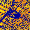
LIght Detection And Ranging (LIDAR) data for terrain and land surveying has contributed to many environmental, engineering and civil applications. However, the analysis of Digital Surface Models (DSMs) from complex LIDAR data is still challenging. Commonly, the first task to investigate LIDAR data point clouds is to separate ground and object points as a preparatory step for further object classification. In this paper, the authors present a novel unsupervised segmentation algorithm - skewness balancing to separate object and ground points efficiently from high resolution LIDAR point clouds by exploiting statistical moments. The results presented in this paper have shown its robustness and its potential for commercial applications.
| Added | 09 Nov 2009 |
| Updated | 09 Nov 2009 |
| Type | Conference |
| Year | 2006 |
| Where | ICPR |
| Authors | David C. Mason, Hong Wei, Marc Bartels |
Comments (0)

