Free Online Productivity Tools
i2Speak
i2Symbol
i2OCR
iTex2Img
iWeb2Print
iWeb2Shot
i2Type
iPdf2Split
iPdf2Merge
i2Bopomofo
i2Arabic
i2Style
i2Image
i2PDF
iLatex2Rtf
Sci2ools
176
Voted
GIS
2007
ACM
2007
ACM
Hierarchical photo organization using geo-relevance
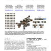
We present a novel framework for organizing large collections of images in a hierarchical way, based on scene semantics. Rather than score images directly, we use them to score the scene in order to identify typical views and important locations which we term Geo-Relevance. This is done by relating each image with its viewing frustum which can be readily computed for huge collections of images nowadays. The frustum contains much more information than only camera position that has been used so far. For example, it distinguishes between a photo of the Eiffel Tower and a photo of a garbage bin taken from the exact same place. The proposed framework enables a summarized display of the information and facilitates efficient browsing. Categories and Subject Descriptors
| Added | 09 Nov 2009 |
| Updated | 09 Nov 2009 |
| Type | Conference |
| Year | 2007 |
| Where | GIS |
| Authors | Boris Epshtein, Eyal Ofek, Yonatan Wexler, Pusheng Zhang |
Comments (0)

