Free Online Productivity Tools
i2Speak
i2Symbol
i2OCR
iTex2Img
iWeb2Print
iWeb2Shot
i2Type
iPdf2Split
iPdf2Merge
i2Bopomofo
i2Arabic
i2Style
i2Image
i2PDF
iLatex2Rtf
Sci2ools
131
Voted
SI3D
2009
ACM
2009
ACM
Multiscale 3D navigation
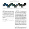
We present a comprehensive system for multiscale navigation of 3-dimensional scenes, and demonstrate our approach on multiscale datasets such as the Earth. Our system incorporates a novel imagebased environment representation which we refer to as the cubemap. Our cubemap allows consistent navigation at various scales, as well as real-time collision detection without pre-computation or prior knowledge of geometric structure. The cubemap is used to improve upon previous work on proximal object inspection (HoverCam), and we present an additional interaction technique for navigation which we call look-and-fly. We believe that our approach to the navigation of multiscale 3D environments offers greater flexibility and ease of use than mainstream applications such as Google Earth and Microsoft Virtual Earth, and we demonstrate our results with this system. CR Categories: H.5.2 [User Interfaces]: Graphical User Interfaces (GUI)—3D graphics;
Computer Graphics | Multiscale 3D Environments | Multiscale Datasets | Multiscale Navigation | SI3D 2009 |
Related Content
| Added | 19 May 2010 |
| Updated | 19 May 2010 |
| Type | Conference |
| Year | 2009 |
| Where | SI3D |
| Authors | James McCrae, Igor Mordatch, Michael Glueck, Azam Khan |
Comments (0)

