Free Online Productivity Tools
i2Speak
i2Symbol
i2OCR
iTex2Img
iWeb2Print
iWeb2Shot
i2Type
iPdf2Split
iPdf2Merge
i2Bopomofo
i2Arabic
i2Style
i2Image
i2PDF
iLatex2Rtf
Sci2ools
Publication
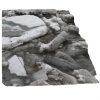
Reconstruction of snow and ice surfaces using multiple view vision techniques
In this paper we describe a vision system for reconstructing the relative structure of snow and ice
surfaces. This effort is one step toward the long-term goal of rendering absolute scale topography.
The target application is mapping of sea ice topography from transiting ships for monitoring sea
ice mass balance. Images of snow and ice scenes pose difficulties in image analysis due to low
contrast and the presence of large areas with low color variation. Since this is a less studied area in
computer vision, our first goal is to obtain a candidate data set, evaluate different camera
configurations, and develop algorithms to process the data. For simplicity, we chose the imaging
of river ice as a surrogate for sea ice because of its accessibility. Multiple views of a scene were
obtained using a variable zoom camera (15-300mm) mounted on a pan-tilt unit which moved
along a 1m baseline. Data were collected at seven locations from heights of 2-100m and viewing
angles of...
Related Content
| Added | 09 Nov 2010 |
| Updated | 09 Nov 2010 |
| Type | Conference |
| Year | 2008 |
| Where | EASTERN SNOW CONFERENCE |
| Authors | GOWRI SOMANATH , ROHITH MV , CATHLEEN A. GEIGER , AND CHANDRA KAMBHAMETTU |
Comments (0)


