92 search results - page 4 / 19 » Automatic and interactive modeling of buildings in urban env... |
GIS
2009
ACM
14 years 8 months ago
2009
ACM
In this paper we present algorithms for automatically generating a road network description from aerial imagery. The road network inforamtion (RNI) produced by our algorithm inclu...
ICCV
1995
IEEE
13 years 11 months ago
1995
IEEE
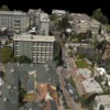
A system has been developed to acquire, extend and re ne 3D geometric site models from aerial imagery. This system hypothesize potential building roofs in an image, automatically ...
GIS
2004
ACM
14 years 8 months ago
2004
ACM
Aerial video provides strong cues for automatic road extraction that are not available in static aerial images. Using stabilized (or geo-referenced) video data, capturing the dist...
CVPR
2008
IEEE
14 years 9 months ago
2008
IEEE
A fast 3D model reconstruction methodology is desirable in many applications such as urban planning, training, and simulations. In this paper, we develop an automated algorithm fo...
CVPR
2012
IEEE
11 years 10 months ago
2012
IEEE
In this paper we address multi-view reconstruction of urban environments using 3D shape grammars. Our formulation expresses the solution to the problem as a shape grammar parse tr...


