122 search results - page 16 / 25 » Flexible Path Planning Using Corridor Maps |
ICRA
2009
IEEE
14 years 2 months ago
2009
IEEE
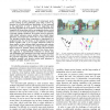
Abstract— We address the problem of vision-based multiperson tracking in busy pedestrian zones using a stereo rig mounted on a mobile platform. Specifically, we are interested i...
PTS
2008
13 years 9 months ago
2008
The state space explosion due to concurrency and timing constraints of concurrent real-time systems (CRTS) presents significant challenges to the verification engineers. In this pa...
ROBOCUP
2007
Springer
14 years 1 months ago
2007
Springer
Abstract. Recent successful SLAM methods employ hybrid map representations combining the strengths of topological maps and occupancy grids. Such representations often facilitate mu...
GIS
2009
ACM
14 years 8 months ago
2009
ACM
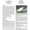
This paper presents a method for automatically converting raw GPS traces from everyday vehicles into a routable road network. The method begins by smoothing raw GPS traces using a...
KI
2004
Springer
14 years 27 days ago
2004
Springer
We present a novel geometric model for robot mapping suited for robots equipped with a laser range finder. The geometric representation is based on shape. Cyclic ordered sets of p...


