325 search results - page 63 / 65 » Maximum margin planning |
143
Voted
DEBU
2010
15 years 2 months ago
2010
Participatory texture documentation (PTD) is a geospatial data collection process in which a group of users (dedicated individuals and/or general public) with camera-equipped mobi...
129
Voted
JIRS
2002
15 years 2 months ago
2002
Disabled people assistance is developing thanks to progress of new technologies. A manipulator arm mounted on a mobile robot can assist the disabled person for the partial restora...
144
Voted
TON
2002
15 years 2 months ago
2002
The existing telecommunications infrastructure in most of the world is adequate to deliver voice and text applications, but demand for broadband services such as streaming video an...
348
Voted
Publication
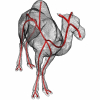
In this paper, we present a novel framework for computing centerlines for both 2D and 3D shape analysis. The framework works as follows: an object centerline point is
selected aut...
426
Voted
Presentation
In this paper, we present a novel framework for computing centerlines for both 2D and 3D shape analysis. The framework works as follows: an object centerline point is selected auto...


