80 search results - page 3 / 16 » Point Cloud Collision Detection |
SIMVIS
2004
13 years 11 months ago
2004
The digitalization of objects from the real world is of great importance, e. g., in many multimedia applications, in 3D computer graphics, and in industrial measurement. In partic...
CVPR
2010
IEEE
14 years 5 months ago
2010
IEEE
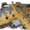
We present a method for detecting and parsing buildings from unorganized 3D point clouds into a compact, hierarchical representation that is useful for high-level tasks. The input...
GIS
2009
ACM
14 years 1 months ago
2009
ACM
This paper presents a novel method to process large scale, ground level Light Detection and Ranging (LIDAR) data to automatically detect geo-referenced navigation attributes (traf...
CGF
2010
13 years 10 months ago
2010
We address the problem of generating quality surface triangle meshes from 3D point clouds sampled on piecewise smooth surfaces. Using a feature detection process based on the cova...
CG
2004
Springer
13 years 9 months ago
2004
Springer
We present a new definition of an implicit surface over a noisy point cloud, based on the weighted least squares approach. It can be evaluated very fast, but artifacts are signifi...


