2652 search results - page 133 / 531 » Positioning using local maps |
136
Voted
CLOUDCOM
2010
Springer
15 years 15 days ago
2010
Springer
-- The MapReduce programming model, introduced by Google, has become popular over the past few years as a mechanism for processing large amounts of data, using sharednothing parall...
PERCOM
2010
ACM
15 years 27 days ago
2010
ACM
Abstract—The construction of world models typically requires laborious survey and cataloguing of a building’s contents. OpenRoomMap attempts to crowd-source this information by...
139
Voted
CVPR
2009
IEEE
16 years 8 months ago
2009
IEEE
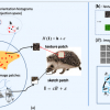
This article proposes a method for learning object templates
composed of local sketches and local textures, and
investigates the relative importance of the sketches and textures
...
109
click to vote
ACL
2010
15 years 16 days ago
2010
In this paper, we address the task of mapping high-level instructions to sequences of commands in an external environment. Processing these instructions is challenging--they posit...
105
click to vote
ICPR
2006
IEEE
16 years 3 months ago
2006
IEEE
Most methods for visual control of robots formulate the robot command in joint or Cartesian space. To move the robot these commands are remapped to motor torques usually requiring...


