896 search results - page 18 / 180 » Restriction categories I: categories of partial maps |
VRCAI
2009
ACM
14 years 3 months ago
2009
ACM
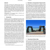
Terrain maps, commonly used for updating elevation values of a moving object (i.e., a traveler), may be conveniently used for detecting and preventing collisions between the trave...
DOCENG
2007
ACM
14 years 19 days ago
2007
ACM
The first steps towards bridging the paper-digital divide have been achieved with the development of a range of technologies that allow printed documents to be linked to digital c...
EGITALY
2006
13 years 10 months ago
2006
Palette re-ordering is a well known and very effective approach for improving the compression of color-indexed images. If the spatial distribution of the indexes in the image is s...
COMPGEOM
2010
ACM
14 years 1 months ago
2010
ACM
The Reeb graph of a scalar function represents the evolution of the topology of its level sets. In this video, we describe a near-optimal output-sensitive algorithm for computing ...
GECCO
2009
Springer
14 years 3 months ago
2009
Springer
This paper introduces a new component based model that makes it relatively simple to prove that certain types of landscapes are elementary. We use the model to reconstruct proofs ...
