35 search results - page 5 / 7 » Terrain Modeling in Synthetic Aperture Radar Images Using Sh... |
CVPR
2007
IEEE
14 years 9 months ago
2007
IEEE
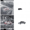
The precise alignment of a 3D model to 2D sensor images to recover the pose of an object in a scene is an important topic in computer vision. In this work, we outline a registrati...
CIARP
2003
Springer
14 years 28 days ago
2003
Springer
The precise knowledge of the statistical properties of synthetic aperture radar (SAR) data plays a central role in image processing and understanding. These properties can be used ...
IGARSS
2009
13 years 5 months ago
2009
In this paper, heterogeneous clutter models are introduced to describe Polarimetric Synthetic Aperture Radar (PolSAR) data. Based on the Spherically Invariant Random Vectors (SIRV...
IGARSS
2009
13 years 5 months ago
2009
The Prairie Pothole Region (PPR) of the US and Canada is characterized by thousands of shallow, water-filled depressions with sizes ranging from a fraction of a hectare to several...
ICPR
2010
IEEE
13 years 9 months ago
2010
IEEE
The Integral Equation Model (IEM) predicts the normalized radar cross section (NRCS) of dielectric surfaces given surface and radar parameters. To derive the surface parameters fr...


