100 search results - page 14 / 20 » gis 2006 |
ENGL
2007
13 years 10 months ago
2007
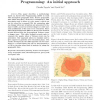
—This paper describes a methodology based on Answer Set Programming (ASP) to work with incomplete geographic data. Source geographic data which describes a risk zone is translate...
JDM
2000
13 years 10 months ago
2000
Advanced Traveler Information Systems (ATIS) require e cient information retrieval and updating in a dynamic environment at di erent geographical scales. ATIS applications are use...
GEOINFORMATICA
2007
13 years 10 months ago
2007
Addresses are the most common georeferencing resource people use to communicate to others a location within a city. Urban GIS applications that receive data directly fromcitizens,...
122
click to vote
GIS
2006
ACM
14 years 12 months ago
2006
ACM
Remotely sensed data, in particular satellite imagery, play many important roles in environmental applications and models. In particular applications that study (rapid) changes in...
GIS
2006
ACM
14 years 12 months ago
2006
ACM
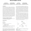
Given a query point and a collection of spatial features, a multi-type nearest neighbor (MTNN) query finds the shortest tour for the query point such that only one instance of eac...


