IGARSS
2009
14 years 12 months ago
2009
94
Voted
IGARSS
2009
14 years 12 months ago
2009
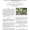
In this paper, we present the obtained first scientific results from CSIR-NLC mobile LIDAR (LIght Detection And Ranging) and its validation/comparison with other ground and space-...
141
Voted
IGARSS
2009
14 years 12 months ago
2009
The effects of shadow in remote sensing imagery are investigated. The measurement of radiance in sunlit and shadowed areas was carried out to investigate the spectral characterist...
173
click to vote
IGARSS
2009
14 years 12 months ago
2009
Interactive visualization of remote sensing data allows the user to explore the full scope of the data sets. Combining and comparing different modalities can give additional insig...
123
click to vote
IGARSS
2009
14 years 12 months ago
2009
The Prairie Pothole Region (PPR) of the US and Canada is characterized by thousands of shallow, water-filled depressions with sizes ranging from a fraction of a hectare to several...
IGARSS
2009
14 years 12 months ago
2009
133
click to vote
IGARSS
2009
14 years 12 months ago
2009
The paper presents a general framework for change detection in radar images, for an operational purpose and in the context of environmental monitoring. This framework is based on ...
124
click to vote
IGARSS
2009
14 years 12 months ago
2009
This paper presents experiments with the ORFEO ToolBox (OTB) developed by the CNES in the context of the Brussels project ARMURS about map updating. Depending on the availability ...
102
Voted
IGARSS
2009
14 years 12 months ago
2009
We examine the analysis of hyperspectral data produced by the Hyperspectral Core Imager of AngloGold Ashanti. The dimension of the data is reduced using diffusion maps and the dat...
109
click to vote
IGARSS
2009
14 years 12 months ago
2009
The vicarious cold and warm calibration methods of Ruf, and Brown and Ruf, have been used to assess the calibration of the WindSat radiometer as well as the biases of the TMI, SSM...
