Free Online Productivity Tools
i2Speak
i2Symbol
i2OCR
iTex2Img
iWeb2Print
iWeb2Shot
i2Type
iPdf2Split
iPdf2Merge
i2Bopomofo
i2Arabic
i2Style
i2Image
i2PDF
iLatex2Rtf
Sci2ools
115
click to vote
SOFSEM
1997
Springer
1997
Springer
Algorithms for Triangulated Terrains
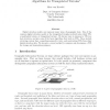
Digital elevation models can represent many types of geographic data. One of the common digital elevation models is the triangulated irregular network
also called TIN, or polyhedral terrain, or triangulated terrain
. We discuss ways to represent a TIN in a data structure, and give some of the basic algorithms that work on TINs. These include retrieving contour lines, computing perspective views, and constructing TINs from other digital elevation data. We also give a recent method to compress and decompress a TIN for storage and transmission purposes.
Common Digital Elevation | Digital Elevation | Digital Elevation Models | SOFSEM 1997 | Theoretical Computer Science |
Related Content
| Added | 08 Aug 2010 |
| Updated | 08 Aug 2010 |
| Type | Conference |
| Year | 1997 |
| Where | SOFSEM |
| Authors | Marc J. van Kreveld |
Comments (0)

