Free Online Productivity Tools
i2Speak
i2Symbol
i2OCR
iTex2Img
iWeb2Print
iWeb2Shot
i2Type
iPdf2Split
iPdf2Merge
i2Bopomofo
i2Arabic
i2Style
i2Image
i2PDF
iLatex2Rtf
Sci2ools
ICPR
2000
IEEE
2000
IEEE
Topographic Maps of Color Images
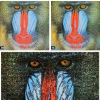
We address the problem of extending topographic maps to color images. A topographic map gives a morphological and a geometrical representation of the information contained in natural images. Two approaches are presented and discussed. The first one is new and consists in defining a total order in IR3 in accordance with the human visual perception of shapes. This allows to define color topographic maps in the same way that what it has been done for graylevel topographic maps. It has the advantage of leading all properties known in the gray-level case to remain true in the color case. But the map contains a so huge quantity of data that it has to be drastically simplified. The second approach, based on a so far unpublished result [4], allows to build a simplified representation by using the geometry given by the luminance component only. We present experiments which illustrate the advantages and the drawbacks of each method.
Color Topographic Maps | Computer Vision | Graylevel Topographic Maps | ICPR 2000 | Simplified Representation |
Related Content
| Added | 09 Nov 2009 |
| Updated | 09 Nov 2009 |
| Type | Conference |
| Year | 2000 |
| Where | ICPR |
| Authors | Bartomeu Coll, Jacques Froment |
Comments (0)

