Free Online Productivity Tools
i2Speak
i2Symbol
i2OCR
iTex2Img
iWeb2Print
iWeb2Shot
i2Type
iPdf2Split
iPdf2Merge
i2Bopomofo
i2Arabic
i2Style
i2Image
i2PDF
iLatex2Rtf
Sci2ools
IROS
2009
IEEE
2009
IEEE
3D mapping for urban service robots
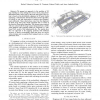
— We present an approach to the problem of 3D map building in urban settings for service robots, using threedimensional laser range scans as the main data input. Our system is based on the probabilistic alignment of 3D point clouds employing a delayed-state information-form SLAM algorithm, for which we can add observations of relative robot displacements efficiently. These observations come from the alignment of dense range data point clouds computed with a variant of the iterative closest point algorithm. The datasets were acquired with our custom built 3D range scanner integrated into a mobile robot platform. Our mapping results are compared to a GISbased CAD model of the experimental site. The results show that our approach to 3D mapping performs with sufficient accuracy to derive traversability maps that allow our service robots navigate and accomplish their assigned tasks on a urban pedestrian area.
| Added | 24 May 2010 |
| Updated | 24 May 2010 |
| Type | Conference |
| Year | 2009 |
| Where | IROS |
| Authors | Rafael Valencia, Ernesto Homar Teniente Avilés, Eduard Trulls, Juan Andrade-Cetto |
Comments (0)

