Free Online Productivity Tools
i2Speak
i2Symbol
i2OCR
iTex2Img
iWeb2Print
iWeb2Shot
i2Type
iPdf2Split
iPdf2Merge
i2Bopomofo
i2Arabic
i2Style
i2Image
i2PDF
iLatex2Rtf
Sci2ools
ICRA
2010
IEEE
2010
IEEE
Improved GPS sensor model for mobile robots in urban terrain
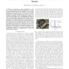
Abstract— Autonomous robot navigation in outdoor scenarios gains increasing importance in various growing application areas. Whereas in non-urban domains such as deserts the problem of successful GPS-based navigation appears to be almost solved, navigation in urban domains particularly in the close vicinity of buildings is still a challenging problem. In such situations GPS accuracy significantly drops down due to multiple signal reflections with larger objects causing the so-called multipath error. In this paper we contribute a novel approach for incorporating multipath errors into the conventional GPS sensor model by analyzing environmental structures from online generated point clouds. The approach has been validated by experimental results conducted with an allterrain robot operating in scenarios requiring closeto-building navigation. Presented results show that positioning accuracy can significantly be improved within urban domains.
Related Content
| Added | 26 Jan 2011 |
| Updated | 26 Jan 2011 |
| Type | Journal |
| Year | 2010 |
| Where | ICRA |
| Authors | Daniel Maier, Alexander Kleiner |
Comments (0)

