490 search results - page 90 / 98 » Automated Generalization of Translation Examples |
205
click to vote
GIS
2007
ACM
16 years 3 months ago
2007
ACM
We consider the problem of extracting a river network and a watershed hierarchy from a terrain given as a set of irregularly spaced points. We describe TerraStream, a "pipeli...
206
click to vote
GIS
2004
ACM
16 years 3 months ago
2004
ACM
Aerial video provides strong cues for automatic road extraction that are not available in static aerial images. Using stabilized (or geo-referenced) video data, capturing the dist...
215
click to vote
GIS
2005
ACM
16 years 3 months ago
2005
ACM
Several application contexts require the ability to use together and compare different geographic datasets (maps) concerning the same or overlapping areas. This is for example the...
233
click to vote
GIS
2006
ACM
16 years 3 months ago
2006
ACM
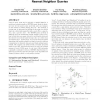
Given a query point and a collection of spatial features, a multi-type nearest neighbor (MTNN) query finds the shortest tour for the query point such that only one instance of eac...
102
click to vote
DAC
2007
ACM
16 years 3 months ago
2007
ACM
With increasing time-to-market pressure and shortening semiconductor product cycles, more and more chips are being designed with library-based methodologies. In spite of this shif...


