1224 search results - page 161 / 245 » Categories of Containers |
VIS
2003
IEEE
14 years 10 months ago
2003
IEEE
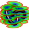
This paper presents a signed distance transform algorithm using graphics hardware, which computes the scalar valued function of the Euclidean distance to a given manifold of co-di...
GIS
2009
ACM
14 years 10 months ago
2009
ACM
The spatio-textual spreadsheet is a conventional spreadsheet where spatial attribute values are specified textually. Techniques are presented to automatically find the textually-s...
GIS
2003
ACM
14 years 10 months ago
2003
ACM
Location-Based Services (LBSs) utilize information about users' locations through location-aware mobile devices to provide services, such as nearest features of interest, the...
GIS
2004
ACM
14 years 10 months ago
2004
ACM
Recent growth of the geospatial information on the web has made it possible to easily access various maps and orthoimagery. By integrating these maps and imagery, we can create in...
GIS
2005
ACM
14 years 10 months ago
2005
ACM
Numerous raster maps are available on the Internet, but the geographic coordinates of the maps are often unknown. In order to determine the precise location of a raster map, we ex...


