18 search results - page 3 / 4 » Exploring a Geographical Dataset with GEOLIS |
EDBT
2010
ACM
13 years 6 months ago
2010
ACM
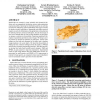
Spatial data are common in many scientific and commercial domains such as geographical information systems and gene/protein expression profiles. Querying for distribution patterns...
GRC
2010
IEEE
13 years 8 months ago
2010
IEEE
—Images with GPS coordinates are a rich source of information about a geographic location. Innovative user services and applications are being built using geotagged images taken ...
GIS
2007
ACM
14 years 9 months ago
2007
ACM
Many Geographic Information System (GIS) applications must handle large geospatial datasets stored in raster representation. Spatial joins over raster data are important queries i...
GECCO
2003
Springer
14 years 1 months ago
2003
Springer
Learning Bayesian networks from data has been studied extensively in the evolutionary algorithm communities [Larranaga96, Wong99]. We have previously explored extending some of the...
FGCS
2006
13 years 8 months ago
2006
Collaborative visualization of large-scale datasets across geographically distributed sites is becoming increasingly important for Earth Sciences. Not only does it enhance our und...


