106 search results - page 7 / 22 » Planning exploration strategies for simultaneous localizatio... |
ICRA
1999
IEEE
13 years 12 months ago
1999
IEEE
Two stereo vision-based mobile robots navigate and autonomously explore their environment safely while building occupancy grid maps of the environment. A novel landmark recognitio...
ICRA
2000
IEEE
14 years 1 days ago
2000
IEEE
A mapmaking robot integrates accumulated sensor data into a data structure that can be used for future localization or planning operations. Localization is the process of determin...
CVIU
2007
13 years 7 months ago
2007
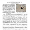
One goal for future Mars missions is for a rover to be able to navigate autonomously to science targets not visible to the rover, but seen in orbital or descent images. This can b...
IROS
2007
IEEE
14 years 1 months ago
2007
IEEE
— The success of NASA’s Mars Exploration Rovers has demonstrated the important benefits that mobility adds to planetary exploration. Very soon, mission requirements will impos...
ICRA
2009
IEEE
14 years 2 months ago
2009
IEEE
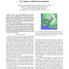
— One of the common applications for outdoor robots is to follow a path in large scale unknown environments. This task is challenging due to the intensive memory requirements to ...


