420 search results - page 64 / 84 » Real-time Terrain Mapping |
JAIR
2006
13 years 7 months ago
2006
In this paper we present pddl+, a planning domain description language for modelling mixed discrete-continuous planning domains. We describe the syntax and modelling style of pddl...
ICRA
2009
IEEE
14 years 2 months ago
2009
IEEE
— Accurate localization of landmarks in the vicinity of a robot is a first step towards solving the SLAM problem. In this work, we propose algorithms to accurately estimate the ...
ISMAR
2008
IEEE
14 years 2 months ago
2008
IEEE
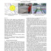
Field workers of utility companies are regularly engaged in outdoor tasks such as network planning, maintenance and inspection of underground infrastructure. Redlining is the term...
GIS
2002
ACM
13 years 7 months ago
2002
ACM
Vector data represents one major category of data managed by GIS. This paper presents a new technique for vector-data display that is able to precisely and efficiently map vector ...
PRESENCE
2002
13 years 7 months ago
2002
In this paper we describe two explorations in the use of hybrid user interfaces for collaborative geographic data visualization. Our first interface combines three technologies; A...


