253 search results - page 7 / 51 » Spatial Data Integrity Constraints in Object Oriented Geogra... |
GIS
2008
ACM
14 years 7 months ago
2008
ACM
This work explores the potential for increased synergy between gazetteers and high-resolution remote sensed imagery. These two data sources are complementary. Gazetteers provide h...
GIS
2002
ACM
13 years 6 months ago
2002
ACM
Geographical information systems are more and more based on a DBMS with spatial extensions, which is also the case for the system described in this paper. The design and implementa...
ADBIS
2004
Springer
14 years 3 days ago
2004
Springer
Many geographical applications deal with spatial objects that cannot be adequately described by determinate, crisp concepts because of their intrinsically indeterminate and vague n...
CVPR
2010
IEEE
14 years 3 months ago
2010
IEEE
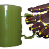
In this paper, we propose a prior for hand pose estimation that integrates the direct relation between a manipulating hand and a 3d object. This is of particular interest for a va...
JIDM
2010
13 years 5 months ago
2010
Data Warehouse (DW), On-Line Analytical Processing (OLAP) and Geographical Information System (GIS) are tools for providing decision-making support. Much research is aimed at inte...


