402 search results - page 28 / 81 » The Shaping of Information by Visual Metaphors |
INFOVIS
2005
IEEE
14 years 1 months ago
2005
IEEE
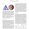
Treemaps are a well-known method for the visualization of attributed hierarchical data. Previously proposed Treemap layout algorithms are limited to rectangular shapes, which caus...
IJWBC
2006
13 years 7 months ago
2006
: Spatial implications of the commonly used `navigation' metaphor have lead many researchers to investigate the relation between individual differences and navigation. This st...
JODL
2006
13 years 7 months ago
2006
We present the results and the lessons learned from two separate and independent studies into the design, development, and evaluation of electronic books for information access: th...
IV
2008
IEEE
14 years 2 months ago
2008
IEEE
Although Internet and WWW phenomena are often described using spatial metaphors, the commonest means of geographic orientation - the map - is little used in online navigation. Map...
COSIT
2003
Springer
14 years 25 days ago
2003
Springer
Abstract. Spatializations are computer visualizations in which nonspatial information is depicted spatially. Spatializations of large databases commonly use distance as a metaphor ...


