119 search results - page 18 / 24 » Visualizing Spatially Varying Distribution Data |
ENVSOFT
2007
13 years 7 months ago
2007
A toolkit for distributed hydrologic modeling at multiple scales using two independent models within a geographic information system is presented. This open-source, freely availab...
CVPR
2009
IEEE
15 years 2 months ago
2009
IEEE
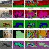
This paper presents a nonparametric approach to labeling
of local image regions that is inspired by recent developments
in information-theoretic denoising. The chief novelty
of ...
VIS
2007
IEEE
14 years 8 months ago
2007
IEEE
Volumetric data commonly has high depth complexity which makes it difficult to judge spatial relationships accurately. There are many different ways to enhance depth perception, su...
AVSS
2007
IEEE
14 years 1 months ago
2007
IEEE
In multi-camera networks rich visual data is provided both spatially and temporally. In this paper a method of human posture estimation is described incorporating the concept of a...
GIS
2002
ACM
13 years 7 months ago
2002
ACM
The focus of this paper is on interoperability issues to achieve data integration in distributed databases for geographic applications. Our concrete application is in the context ...


