200
Voted
GIS
2008
ACM
16 years 3 months ago
2008
ACM
Many aspects of spatial language concerned with relationships between spatial entities are essentially vague. Current GIS technology provides very little support for dealing with ...
208
click to vote
GIS
2008
ACM
16 years 3 months ago
2008
ACM
Isochrones are defined as the set of all points from which a specific point of interest is reachable within a given time span. This demo paper presents a solution to compute isoch...
213
click to vote
GIS
2008
ACM
16 years 3 months ago
2008
ACM
Cyberinfrastructure integrates information and communication technologies to enable high-performance, distributed, and collaborative knowledge discovery, and promises to revolutio...
208
click to vote
GIS
2008
ACM
16 years 3 months ago
2008
ACM
Geovisualization has traditionally played a critical role in analysis and decision-making, but recent developments have also brought a revolution in widespread online access to ge...
219
click to vote
GIS
2008
ACM
16 years 3 months ago
2008
ACM
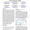
Given a spatial crime data warehouse, that is updated infrequently and a set of operations O as well as constraints of storage and update overheads, the index type selection probl...
252
click to vote
GIS
2008
ACM
16 years 3 months ago
2008
ACM
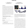
This paper presents an automatic algorithm which reconstructs building models from airborne LiDAR (light detection and ranging) data of urban areas. While our algorithm inherits t...
232
click to vote
GIS
2008
ACM
16 years 3 months ago
2008
ACM
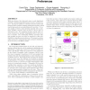
With the advent of the data grid came a novel distributed scientific computing paradigm known as service-oriented science. Among the plethora of systems included under this framew...

