GIS
2006
ACM
15 years 14 days ago
2006
ACM
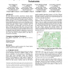
The large amount of patterns generated by frequent pattern mining algorithms has been extensively addressed in the last few years. In geographic pattern mining, besides the large ...
107
click to vote
GIS
2006
ACM
15 years 14 days ago
2006
ACM
The W3C's Semantic Web Activity is illustrating the use of semantics for information integration, search, and analysis. However, the majority of the work in this community ha...
GIS
2006
ACM
15 years 14 days ago
2006
ACM
In this paper we describe work on the automatic recognition of island structures. In an initial phase several test persons were asked to mark groups of islands that they perceived...
GIS
2006
ACM
15 years 14 days ago
2006
ACM
GIS
2006
ACM
15 years 14 days ago
2006
ACM
The result of a distance join operation on two sets of objects R, S on a spatial network G is a set P of object pairs <p, q>, p R, q S such that the distance of an object ...
GIS
2006
ACM
15 years 14 days ago
2006
ACM
Topological relationships between objects in space are of great importance in many disciplines. Recently, topological relationships have been defined for complex spatial objects. ...
GIS
2006
ACM
15 years 14 days ago
2006
ACM
Given a query point and a collection of spatial features, a multi-type nearest neighbor (MTNN) query finds the shortest tour for the query point such that only one instance of eac...
GIS
2006
ACM
15 years 14 days ago
2006
ACM
Situational awareness (SA) applications monitor the real world and the entities therein to support tasks such as rapid decision-making, reasoning, and analysis. Raw input about un...
GIS
2006
ACM
15 years 14 days ago
2006
ACM
Location information gathered from a variety of sources in the form of sensor data, video streams, human observations, and so on, is often imprecise and uncertain and needs to be ...
GIS
2006
ACM
15 years 14 days ago
2006
ACM
Geography Markup Language (GML) is an XML-based language for the markup, storage, and exchange of geospatial data. It provides a rich geospatial vocabulary and allows flexible doc...
