114
Voted
VISUALIZATION
1997
IEEE
15 years 6 months ago
1997
IEEE
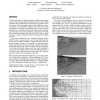
Terrain visualization is a difficult problem for applications requiring accurate images of large datasets at high frame rates, such as flight simulation and ground-based aircraf...
144
Voted
VISUALIZATION
1997
IEEE
15 years 6 months ago
1997
IEEE
The term Tele-Immersion was first used in October 1996 as the title of a workshop the Electronic Visualization Laboratory (EVL) at University of Illinois at Chicago (UIC) organize...
121
click to vote
VISUALIZATION
1997
IEEE
15 years 6 months ago
1997
IEEE
: We present the use of mapping functions to automatically generate levels of detail with known error bounds for polygonal models. We develop a piece-wise linear mapping function f...
102
click to vote
VISUALIZATION
1997
IEEE
15 years 6 months ago
1997
IEEE
This paper discusses a unique way to visualize height field data – the use of solid fabricated parts with a photomapped texture to display scalar information. In this process, t...
111
click to vote
VISUALIZATION
1997
IEEE
15 years 6 months ago
1997
IEEE
We present an image synthesis methodology and a system built around it. Given a sparse set of photographs taken from unknown viewpoints, the system generates images from new, diff...
113
click to vote
VISUALIZATION
1997
IEEE
15 years 6 months ago
1997
IEEE
In the area of scientific visualization, input data sets are often very large. In visualization of Computational Fluid Dynamics (CFD) in particular, input data sets today can surp...
115
click to vote
VISUALIZATION
1997
IEEE
15 years 6 months ago
1997
IEEE
We introduce the contour spectrum, a user interface component that improves qualitative user interaction and provides real-time exact quanti cation in the visualization of isocont...
VISUALIZATION
1997
IEEE
15 years 6 months ago
1997
IEEE
This paper outlines a method to dynamically replace portals with textures in a cell-partitioned model. The rendering complexity is reduced to the geometry of the current cell thus...
104
click to vote
VISUALIZATION
1997
IEEE
15 years 6 months ago
1997
IEEE
This paper discusses the problem of subdividing unstructured mesh topologies containing hexahedra, prisms, pyramids and tetrahedra into a consistent set of only tetrahedra, while ...
