Free Online Productivity Tools
i2Speak
i2Symbol
i2OCR
iTex2Img
iWeb2Print
iWeb2Shot
i2Type
iPdf2Split
iPdf2Merge
i2Bopomofo
i2Arabic
i2Style
i2Image
i2PDF
iLatex2Rtf
Sci2ools
115
click to vote
FSR
2007
Springer
2007
Springer
Experiments in Navigation and Mapping with a Hovering AUV
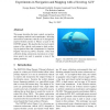
This paper describes the basic control, navigation, and mapping methods and experiments a hovering autonomous underwater vehicle (AUV) designed to explore flooded cenotes in Mexico as part of the DEPTHX project. We describe the low level control system of the vehicle, and present a dead reckoning navigation filter that compensates for frequent Doppler velocity log (DVL) dropouts. Sonar data collected during autonomous excursions in a limestone quarry are used to generate a map of the quarry geometry.
Autonomous Underwater Vehicle | Dead Reckoning Navigation | Frequent Doppler Velocity | FSR 2007 | Robotics |
| Added | 07 Jun 2010 |
| Updated | 07 Jun 2010 |
| Type | Conference |
| Year | 2007 |
| Where | FSR |
| Authors | George Kantor, Nathaniel Fairfield, Dominic Jonak, David Wettergreen |
Comments (0)

