Free Online Productivity Tools
i2Speak
i2Symbol
i2OCR
iTex2Img
iWeb2Print
iWeb2Shot
i2Type
iPdf2Split
iPdf2Merge
i2Bopomofo
i2Arabic
i2Style
i2Image
i2PDF
iLatex2Rtf
Sci2ools
IJRR
2010
2010
A High-rate, Heterogeneous Data Set From The DARPA Urban Challenge
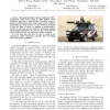
This paper describes a data set collected by MIT's autonomous vehicle Talos during the 2007 DARPA Urban Challenge. Data from a high precision navigation system, 5 cameras, 12 SICK planar laser range scanners, and a Velodyne high density laser range scanner were synchronized and logged to disk for 90km of travel. In addition to documenting a number of large loop closures useful for developing mapping and localization algorithms, this data set also records the first robotic traffic jam and two autonomous vehicle collisions. It is our hope that this data set will be useful to the autonomous vehicle community, especially those developing robotic perception capabilities.
| Added | 18 May 2011 |
| Updated | 18 May 2011 |
| Type | Journal |
| Year | 2010 |
| Where | IJRR |
| Authors | Albert S. Huang, Matthew E. Antone, Edwin Olson, Luke Fletcher, David Moore, Seth J. Teller, John J. Leonard |
Comments (0)

