Free Online Productivity Tools
i2Speak
i2Symbol
i2OCR
iTex2Img
iWeb2Print
iWeb2Shot
i2Type
iPdf2Split
iPdf2Merge
i2Bopomofo
i2Arabic
i2Style
i2Image
i2PDF
iLatex2Rtf
Sci2ools
ICRA
2006
IEEE
2006
IEEE
Ridge-valley Path Planning for 3D Terrains
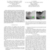
Abstract— This paper presents a tactical path planning algorithm for following ridges or valleys across a 3D terrain. The intent is to generate a path that enables an unmanned vehicle to surveil with maximum observability by traversing the ridges of a terrain or to operate with maximum covertness by navigating the valleys. The input to the algorithm is a 3D triangle mesh model for the terrain of interest. This mesh may be non-uniform and non-regular. Thus, the algorithm leverages research from computer graphics and computer vision to identify ridge-valley features on the terrain. These features serve as “obstacles” for an artificial potential field algorithm. The valleys are obstacles for a surveillance path, or the ridges are obstacles for a covert path. We incorporate geodesic—rather than Euclidean—distances into the potential field formulation to extend path planning to 3D surfaces. We present the theory of our proposed algorithm and provide experimental results.
Algorithm Leverages Research | ICRA 2006 | Path Planning Algorithm | Potential field Algorithm | Robotics |
| Added | 11 Jun 2010 |
| Updated | 11 Jun 2010 |
| Type | Conference |
| Year | 2006 |
| Where | ICRA |
| Authors | David L. Page, Andreas Koschan, Mongi A. Abidi, James L. Overholt |
Comments (0)

