133 search results - page 16 / 27 » Geographic Digital Content Components |
ICMLA
2008
13 years 9 months ago
2008
We have designed a framework for content based appraisal of documents. Our motivation is to provide computer assisted support for answering several appraisal criteria according to...
ISMAR
2005
IEEE
14 years 1 months ago
2005
IEEE
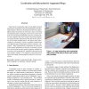
Paper-based cartographic maps provide highly detailed information visualisation with unrivalled fidelity and information density. Moreover, the physical properties of paper affor...
KDD
2008
ACM
14 years 8 months ago
2008
ACM
Record label companies would like to identify potential artists as early as possible in their careers, before other companies approach the artists with competing contracts. The va...
SAC
2005
ACM
14 years 1 months ago
2005
ACM
: A learning system to facilitate the integration of Geographical Information Systems (GIS) into the Civil Engineering curriculum is described in this paper. The principal learning...
SAC
2009
ACM
14 years 2 months ago
2009
ACM
IP multicast is increasingly seen as efficient mode of live content distribution in the Internet to significantly large subscriber bases. Despite its numerous benefits over IP u...


