211 search results - page 30 / 43 » Image fusion techniques for remote sensing applications |
BMVC
1998
13 years 9 months ago
1998
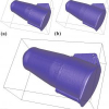
A novel technique for multi-scale smoothing of a free-form 3-D surface is presented. Complete triangulated models of 3-D objects are constructed (through fusion of range images) a...
GIS
2006
ACM
14 years 8 months ago
2006
ACM
Remotely sensed data, in particular satellite imagery, play many important roles in environmental applications and models. In particular applications that study (rapid) changes in...
VIS
2007
IEEE
14 years 9 months ago
2007
IEEE
Abstract-- This paper describes a novel method for creating surface models of multi-material components using dual energy computed tomography (DECT). The application scenario is me...
WWW
2002
ACM
14 years 8 months ago
2002
ACM
Network and server-centric computing paradigms are quickly returning to being the dominant methods by which we use computers. Web applications are so prevalent that the role of a ...
GIS
2004
ACM
14 years 8 months ago
2004
ACM
Spatial, temporal and spatio-temporal aggregates over continuous streams of remotely sensed image data build a fundamental operation in many applications in the environmental scie...


