720 search results - page 107 / 144 » Mobile robot navigation using sensor fusion |
IROS
2009
IEEE
14 years 2 months ago
2009
IEEE
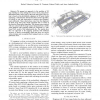
— We present an approach to the problem of 3D map building in urban settings for service robots, using threedimensional laser range scans as the main data input. Our system is ba...
SCIA
2005
Springer
14 years 1 months ago
2005
Springer
Estimating camera position and posture can be applied to the fields of augmented reality and robot navigation. In these fields, to obtain absolute position and posture of the cam...
EPIA
2009
Springer
13 years 11 months ago
2009
Springer
When building a representation of the environment for a robot in a multi-agent application, as is the case of robotic soccer, sensor and information fusion of several elements of t...
IROS
2009
IEEE
14 years 2 months ago
2009
IEEE
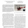
— We consider the problem of autonomously flying a helicopter in indoor environments. Navigation in indoor settings poses two major challenges. First, real-time perception and r...
IROS
2008
IEEE
14 years 2 months ago
2008
IEEE
— This paper introduces a localization based on GPS and laser measurements for urban and non-urban outdoor environments. In this approach, the GPS pose is Kalman filtered using w...


