420 search results - page 7 / 84 » Real-time Terrain Mapping |
ICCV
2007
IEEE
14 years 9 months ago
2007
IEEE
We present a viewpoint-based approach for the quick fusion of multiple stereo depth maps. Our method selects depth estimates for each pixel that minimize violations of visibility ...
ICRA
2007
IEEE
14 years 1 months ago
2007
IEEE
— A central problem in robotics is planning a collision-free path for a moving object in an environment with obstacles. Contemporary applications require a path planner that is f...
ICRA
2005
IEEE
14 years 1 months ago
2005
IEEE
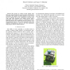
— We present an outdoor terrain planner that finds near optimal trajectories under dynamic and kinematic constraints. The planner can find solutions in close to real time by re...
ICCV
2003
IEEE
14 years 9 months ago
2003
IEEE
Ego-motion estimation for an agile single camera moving through general, unknown scenes becomes a much more challenging problem when real-time performance is required rather than ...
ECRTS
2004
IEEE
13 years 11 months ago
2004
IEEE
We present an approach to partitioning and mapping for multicluster embedded systems consisting of time-triggered and eventtriggered clusters, interconnected via gateways. We have...


