62 search results - page 8 / 13 » Terrain Modelling for Planetary Exploration |
ATAL
2010
Springer
13 years 8 months ago
2010
Springer
d Abstract) Piyoosh Mukhija IIIT Hyderabad Rahul Sawhney IIIT Hyderabad K Madhava Krishna IIIT Hyderabad We present an algorithm for multi robotic exploration of an unknown terrai...
ICRA
2006
IEEE
14 years 1 months ago
2006
IEEE
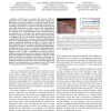
— In this paper we predict the amount of slip an exploration rover would experience using stereo imagery by learning from previous examples of traversing similar terrain. To do t...
ICRA
2008
IEEE
14 years 1 months ago
2008
IEEE
Abstract— In this paper, we explore the capabilities of actuated models of the compass gait walker on rough terrain. We solve for the optimal high-level feedback policy to negoti...
GIS
2008
ACM
13 years 8 months ago
2008
ACM
Bintrees based on longest edge bisection and hierarchies of diamonds are popular multiresolution techniques on regularly sampled terrain datasets. In this work, we consider sparse...
TVCG
2010
13 years 5 months ago
2010
—We present TanGeoMS, a tangible geospatial modeling visualization system that couples a laser scanner, projector, and a flexible physical three-dimensional model with a standar...


